Your smartphone now knows exactly where to find the Milky Way tonight!
In fact, light pollution affects over 80% of the world’s population, but artificial intelligence is revolutionising how we discover pristine dark skies.
AI light pollution maps combine satellite data with machine learning algorithms to predict optimal stargazing conditions with unprecedented accuracy.
Gone are the days of driving hours into the wilderness only to find hazy skies or unexpected light domes.
These intelligent mapping systems analyse real-time atmospheric conditions, weather patterns, and light emission data to guide astronomers and astrophotographers to the perfect celestial viewing spots.
📘 Table of Contents
What Are AI Light Pollution Maps?
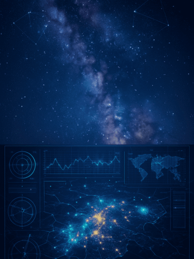
AI light pollution maps represent the cutting-edge fusion of satellite technology, machine learning, and astronomical science to create dynamic, predictive models of sky brightness across the globe. Unlike static maps that show historical light pollution data, these intelligent systems continuously process vast amounts of information to provide real-time recommendations for optimal stargazing locations.
Key Components of AI Light Pollution Mapping
Satellite Data Integration
Modern AI systems utilise data from the Visible Infrared Imaging Radiometer Suite (VIIRS) aboard the Suomi NPP satellite, which captures nighttime light emissions with remarkable precision. This data is processed through neural networks that can distinguish between different types of artificial lighting and natural phenomena. The satellite imagery is updated regularly, ensuring that maps reflect current lighting conditions rather than outdated information.
Machine Learning Algorithms
Sophisticated AI models analyse patterns in light emission data, weather conditions, and atmospheric variables to predict sky quality at specific locations and times. These algorithms learn from millions of data points, including historical observations, meteorological data, and citizen science contributions. The machine learning systems can identify subtle correlations between factors like humidity, cloud cover, and light scattering that human analysts might miss.
Real-Time Environmental Processing
AI systems integrate multiple data streams including weather forecasts, atmospheric transparency measurements, and local event information to provide dynamic recommendations. The algorithms process information about moon phases, seasonal atmospheric conditions, and even temporary light sources like festivals or construction projects.
Bortle Scale Integration
Modern AI light pollution maps incorporate the Bortle Dark-Sky Scale, which classifies sky brightness on a scale from 1 (pristine dark sky) to 9 (inner-city sky). Machine learning algorithms correlate satellite measurements with Bortle classifications to provide standardised sky quality assessments.
How Do AI Light Pollution Maps Work for Stargazing?
The sophisticated process behind AI light pollution maps involves multiple layers of data analysis and predictive modelling that work together to deliver precise stargazing recommendations. Understanding this process helps astronomers make better use of these powerful tools and appreciate the technology that makes modern dark sky discovery possible.
Data Collection and Processing Pipeline
💡 Pro Tip
The best AI light pollution maps update their predictions every few hours, incorporating the latest weather data and atmospheric conditions. Check for recent updates before heading out for your stargazing session!
Multi-Satellite Synthesis
AI systems aggregate data from multiple satellite sources, including VIIRS, MODIS, and Landsat imagery, to create comprehensive light pollution assessments. The algorithms normalise data from different sensors and time periods to ensure consistency and accuracy. This multi-source approach provides redundancy and helps identify temporary anomalies in light emission patterns.
Atmospheric Modelling Integration
Advanced AI models incorporate detailed atmospheric data, including aerosol optical depth, water vapour content, and atmospheric turbulence measurements. These factors significantly impact sky transparency and stellar visibility, making their inclusion crucial for accurate predictions. The algorithms use meteorological models to forecast how atmospheric conditions will evolve throughout the night.
Ground-Truth Validation
AI systems continuously validate their predictions against real-world observations from professional observatories, amateur astronomers, and citizen science projects. This feedback loop allows the machine learning algorithms to refine their models and improve accuracy over time. The validation process includes data from Sky Quality Metres (SQM), which provide precise measurements of sky brightness.
Why Are AI-Powered Dark Sky Maps Better Than Traditional Methods?
Traditional light pollution mapping relied on static datasets and manual observations that quickly became outdated, while AI-powered systems offer dynamic, real-time insights that adapt to changing conditions. The superiority of AI-driven approaches becomes evident when comparing accuracy, timeliness, and practical utility for modern stargazers.
Advantages Over Static Light Pollution Maps
- Real-Time Adaptability: Unlike traditional maps that might be years old, AI systems process current data to reflect immediate lighting conditions and temporary changes.
- Predictive Capabilities: AI light pollution maps don’t just show current conditions—they forecast future sky quality based on weather patterns, atmospheric trends, and historical data.
- Personalised Recommendations: Machine learning algorithms can learn individual preferences and observing goals to provide customised location recommendations.
- Integration with Astronomical Events: AI systems correlate light pollution data with astronomical events, moon phases, and seasonal phenomena to optimise viewing recommendations.
📝 Did You Know?
AI light pollution maps can predict sky conditions up to 7 days in advance with remarkable accuracy, allowing you to plan your stargazing adventures well ahead of time. This is especially valuable for astrophotography sessions that require specific atmospheric conditions.
Which AI Light Pollution Map Tools Should Stargazers Use?
The landscape of AI-powered light pollution mapping tools continues to evolve rapidly, with several platforms offering unique features and capabilities for different types of users. Selecting the right tool depends on specific needs, technical expertise, and observing goals.
Professional-Grade AI Mapping Platforms
- Light Pollution Map (lightpollutionmap.info) — This comprehensive platform integrates VIIRS satellite data with machine learning algorithms to provide detailed light pollution assessments worldwide. Visit Light Pollution Map
- DarkSiteFinder Advanced Analytics — The latest version incorporates AI-driven recommendations that go beyond simple light pollution visualisation. The platform’s algorithms analyse user preferences, equipment specifications, and observing targets. Check DarkSiteFinder
- ClearOutside AI Integration — This weather-focused platform has integrated AI light pollution mapping to provide comprehensive observing condition forecasts. The machine learning algorithms correlate weather patterns with light pollution data. Explore ClearOutside
- Globe at Night AI Enhanced — The citizen science project has incorporated machine learning to process and validate community-contributed sky brightness measurements. Join Globe at Night
🧰 Essential Gear for AI-Guided Stargazing
- Red LED Headlamp — Preserve your night vision while navigating with AI map recommendations. Check on Amazon
- Sky Quality Metre — Validate AI predictions with your own measurements. Check on Amazon.
- Portable Weather Station — Monitor real-time conditions that affect AI predictions. Check on Amazon.
How Can You Find the Best Dark Sky Locations Using AI Maps?
Maximising the potential of AI light pollution maps requires understanding how to interpret their data and integrate multiple factors into your observing plans. The most successful stargazers combine AI recommendations with practical considerations and local knowledge to identify truly exceptional viewing locations.
Strategic Location Selection Process
Multi-Factor Analysis
Effective use of AI light pollution maps involves considering multiple variables simultaneously rather than focusing solely on the darkest areas. The algorithms can weight factors like travel distance, accessibility, safety, and local regulations to provide balanced recommendations. Consider how elevation affects both light pollution and atmospheric conditions—higher locations often offer better transparency even if they’re not in the darkest zones.
Temporal Optimisation
AI systems excel at identifying optimal timing for observations at specific locations, considering factors like moon phases, seasonal atmospheric conditions, and local weather patterns. Use the predictive capabilities to plan observations during astronomical events when sky conditions are forecast to be exceptional.
💡 Planning Tip
Set up alerts in your chosen AI light pollution map app for when conditions at your favourite locations reach optimal levels. Many platforms offer push notifications when sky quality exceeds your specified thresholds.
Equipment-Specific Recommendations
Advanced AI platforms can tailor location recommendations based on your specific equipment and observing goals. For astrophotography, the algorithms might prioritise locations with stable atmospheric conditions and minimal wind, even if they’re slightly brighter than alternatives. Visual observers might receive recommendations based on limiting magnitude requirements for specific targets.
Safety and Accessibility Integration
Modern AI light pollution maps incorporate safety data, accessibility information, and legal considerations into their recommendations. The algorithms can identify locations that offer excellent sky quality while ensuring safe access and legal observing rights.
What Impact Do AI Light Pollution Maps Have on Conservation?
The integration of artificial intelligence into light pollution mapping has created powerful new tools for environmental conservation and dark sky preservation efforts. These technologies are enabling more effective advocacy, policy development, and ecosystem protection initiatives worldwide.
Conservation Applications and Benefits
- Biodiversity Protection Insights: AI light pollution maps are revealing the complex relationships between artificial lighting and wildlife behaviour, particularly for nocturnal species and migratory animals.
- Policy Development Support: Municipal governments and conservation organisations are leveraging AI light pollution data to develop more effective lighting ordinances and dark sky protection policies.
- Tourism and Economic Impact Analysis: AI light pollution maps are helping communities understand the economic value of their dark skies and develop sustainable astronomy tourism initiatives.
- Research and Monitoring Capabilities: Scientific researchers are using AI-enhanced light pollution data to study long-term trends and their impacts on various biological and ecological systems.
⚠️ Conservation Alert
Light pollution is increasing globally by 2% per year. AI mapping tools are crucial for tracking these changes and implementing effective conservation strategies before we lose more of our natural dark sky heritage.
Where Are the World’s Best AI-Mapped Dark Sky Destinations?
AI light pollution mapping has identified and verified exceptional dark sky locations around the globe, providing unprecedented insight into the world’s premier stargazing destinations. These AI-verified locations offer optimal conditions for astronomical observation and represent the gold standard for dark sky experiences.
Premier Global Dark Sky Destinations
Wadi Rum, Jordan
AI analysis confirms this UNESCO World Heritage site as one of the world’s darkest accessible locations, with Bortle Class 1 skies and exceptional atmospheric stability. The AI algorithms have mapped optimal viewing areas within the protected zone and identified seasonal variations in sky quality. Machine learning models predict consistently excellent conditions throughout most of the year.
Atacama Desert, Chile
The AI mapping reveals why this region hosts multiple world-class observatories, with exceptional atmospheric transparency and minimal moisture content. Machine learning algorithms have identified microclimates within the desert that offer superior conditions for different types of observations. The AI system tracks seasonal patterns and can predict optimal viewing periods months in advance.
Jasper National Park, Canada
This Dark Sky Preserve benefits from AI monitoring that tracks light pollution from surrounding communities and predicts optimal viewing conditions. The machine learning system has mapped internal light sources within the park and identified areas with the darkest skies for serious astronomical work. AI algorithms account for seasonal variations in tourist activity and their impact on local lighting conditions.
Isle of Rum, Scotland
AI analysis has confirmed this remote Scottish island as Europe’s premier dark sky destination, with machine learning algorithms mapping the complex interactions between maritime weather and sky quality. The AI system tracks how Atlantic weather patterns affect atmospheric transparency and provides detailed forecasts for astronomical observation planning.
📢 Plan Your Dark Sky Adventure
Ready to explore these incredible destinations? Use AI light pollution maps to time your visit perfectly and discover the exact locations within each area that offer the best viewing conditions for your specific interests.
📖 Glossary of AI Light Pollution Map Terms
New to AI Light Pollution Maps? This glossary simplifies the essential terms for 2025 stargazing success.
Whether you’re curious about satellite overlays, SQM readings, or sky radiance, this resource will boost your confidence.
Learn the language behind the tech to better navigate tools like lightpollutionmap.info and plan perfect night sky adventures.
Conclusion
AI light pollution maps are fundamentally transforming how we explore and protect our night skies, offering unprecedented precision in finding optimal stargazing locations while supporting crucial conservation efforts. These intelligent systems combine satellite technology, machine learning, and real-time data processing to guide astronomers to the darkest, clearest skies available anywhere on Earth.
From professional observatories to weekend stargazers, AI-powered tools are democratising access to exceptional astronomical viewing experiences. The technology continues evolving rapidly, with new features and capabilities emerging regularly to serve the growing community of night sky enthusiasts.
Ready to discover your perfect dark sky destination? Start exploring AI light pollution maps today and join the revolution in intelligent stargazing. The universe is waiting, and artificial intelligence is showing us exactly where to look!
Affiliate Disclosure
Some links in this post may be affiliate links. As the creator of SunnyDaysGo.com, I only recommend gear and gadgets I believe bring real value to your outdoor adventures. If you click a link and make a purchase, I may earn a small commission at no extra cost to you. Thank you for supporting my work and helping keep this site ad-free and growing!